| Distance | 75 km (approx.) |
| Duration | 4–5 days |
| Difficulty | Moderate (higher early/late season) |
| Max elevation | Atsunta Pass — 3,431 m |
| Total elevation gain/loss | Approx. 3,500 m up and down |
| Start point | Upper Omalo, Tusheti region |
| End point | Shatili, Khevsureti region |
| Best season | July – August |
| Trailhead GPS | 42.3820°N, 45.5480°E (Upper Omalo) |
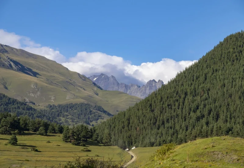
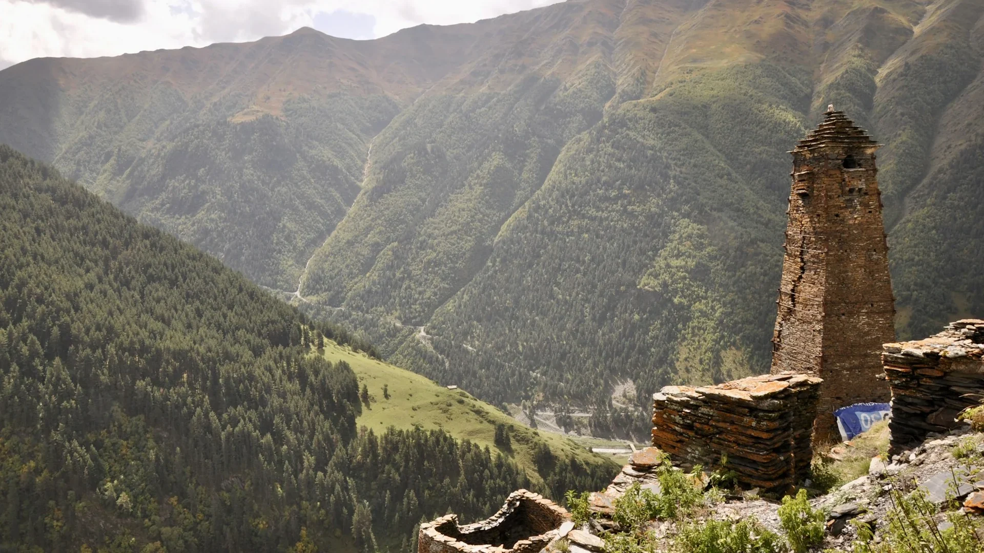
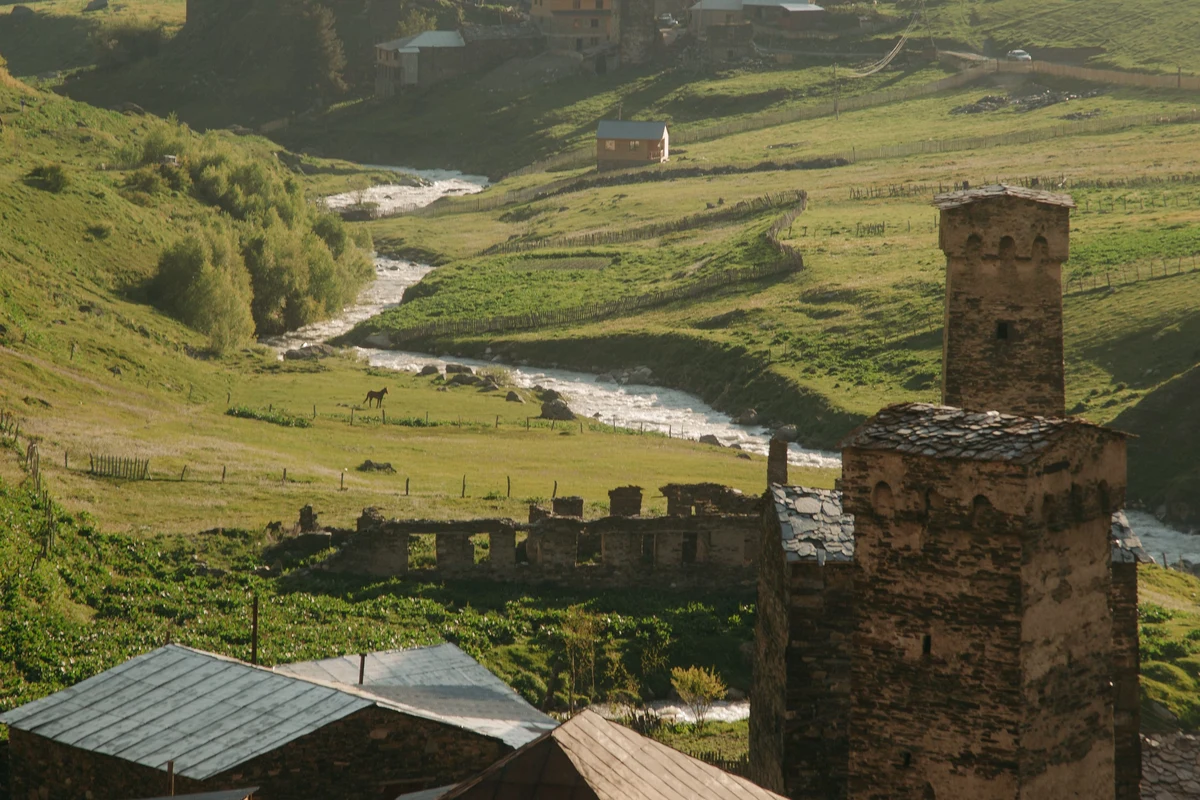
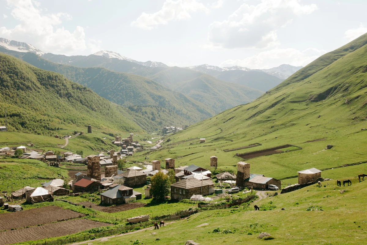
The Omalo to Shatili trek connects two of Georgia’s most isolated highland regions — Tusheti and Khevsureti — along an old shepherd’s path that crosses the Atsunta Pass at 3,431 m. Over 75 km and four to five days, you move through medieval stone villages, alpine meadows, and a river valley that requires multiple crossings before the final pass ascent.
This is one of the most-walked long routes in the Georgian Caucasus, but it still requires real planning. Both Tusheti and Khevsureti are difficult to reach, have no ATMs, and limited phone signal. The route passes close to the Russian border and you will need to show your passport at checkpoints in Girevi.
The first two days from Omalo follow a jeep track connecting Tusheti villages — walkable but not technically demanding. The trail turns into a footpath from Girevi onwards, and the day crossing Atsunta Pass is the hardest on the route. If you are newer to multi-day hiking, four days is a tight schedule; five is more comfortable.
Route Overview
The standard route runs: Upper Omalo → Dartlo → Parsma → Girevi → Kvakhidi meadows → Atsunta Pass → Khidotanis ridge → Mutso → Shatili.
The first two days to Girevi follow the jeep road through Tusheti’s Pirikita valley. From Girevi, the route leaves vehicle access behind and becomes a clear but unmaintained shepherd path. It is marked with painted flags on rocks and trees, and a GPX track is worth downloading before you go — signal in the valleys is unreliable.
An alternative for the first day and a half runs along the Pirikita ridge above the valley, offering wider panoramic views but less village contact. It rejoins the main route before Girevi.
Daily Stages
Day 1: Upper Omalo to Dartlo — 12 km, 4–6 hours, 438 m gain / 206 m loss
The trail starts from the old towers in Upper Omalo’s main square and descends through forest before joining the dirt road south. One short steep section aside, it is a straightforward walk. Dartlo has a few guesthouses, a restaurant, and a small shop where you can restock basics.
Day 2: Dartlo to Girevi — 14.5 km, 5–7 hours, 405 m gain / 670 m loss
Still on the dirt road. Parsma village sits midway and has food options. At Girevi, register with the border guards and present your passport — do this the same afternoon you arrive to avoid delays the next morning. Guards are friendly. Guesthouses are available; camping near the river is also common.
Day 3: Girevi to Kvakhidi Meadows — 12 km, 7–8 hours, 978 m gain / 584 m loss
This is where the terrain changes. The path climbs above the Kvakhidistkali river, winding past old farms and abandoned ruins before dropping to the meadows at around 2,400 m. There is a wooden bridge crossing and a shepherd camp that sometimes sells bread, cheese, and wine. Water is easy to find along this section. Border guards may check permits on horseback.
Day 4: Kvakhidi Meadows to Khidotanis Ridge (via Atsunta Pass) — 12 km, 9–10 hours, 1,352 m gain / 866 m loss
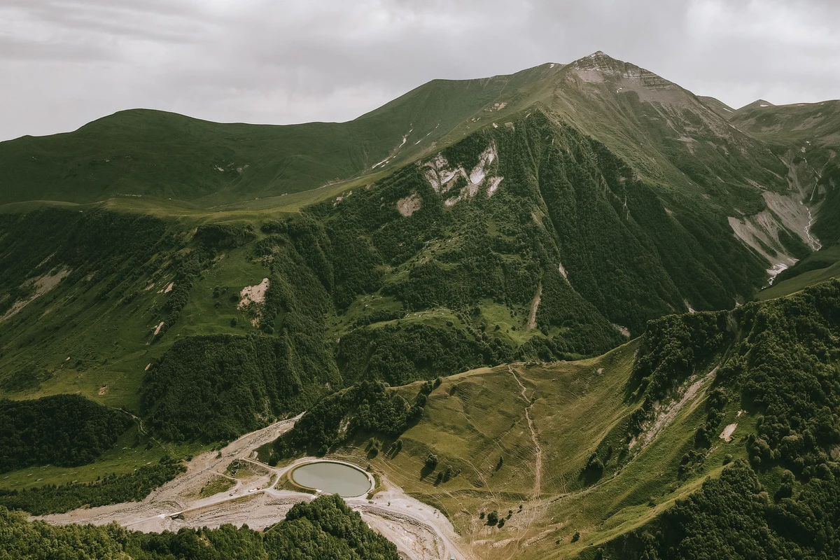
The hardest day. You follow the river valley with two crossings — one on a wooden bridge, one ford where you will get wet. A rock with “Exit Shatili” marks the spot. From there the terrain shifts from grass to scree and the path climbs steeply to Atsunta Pass at 3,431 m. Some hikers experience mild altitude symptoms (headache, slower pace, reduced appetite) on this day — drink water and go steady. The pass offers a clear view back into Tusheti and forward into Khevsureti. Camp at or just below the Khidotanis ridge; water sources are scarce beyond the descent.
Day 5: Khidotanis Ridge to Shatili — approx. 19 km, 7–8 hours
A steep initial descent of around 400 m, then a gravel road walk to Mutso village. Most hikers stop to explore the Mutso fortress ruins before continuing to Shatili. The last 12 km from Mutso to Shatili is a flat road; cars are common and hitching is possible. Shatili has hotels and guesthouses, the most developed accommodation on the route.
Omalo Shatili Difficulty
Most sources rate this trek moderate, but with conditions attached. The total elevation gain and loss is around 3,500 m across five days, and the route is 75 km long. The pass day pushes this into moderate-to-hard territory for anyone not used to multi-day hiking.
What raises the difficulty in practice: river crossings that are deeper in early season (June) or after rain; the altitude at Atsunta Pass (3,431 m) causing symptoms in some hikers; and the weight of a self-supported pack if you are not using a horseman. Early and late season — before mid-July and after September — the pass may have snow and the rivers run higher, which changes the risk profile significantly.
| Border checkpoints: The route passes near the Russian border. Bring your passport. Register at the Girevi border post on arrival; a guard may check your permit again on Day 3. The trek is sometimes closed before late June — call the Tusheti National Park Administration (+995 577 101 892) if you are travelling in early summer. |
Omalo Shatili Camping and Accommodation
Guesthouses are available in Omalo, Dartlo, Parsma, Girevi, and Shatili. A bed with dinner and breakfast typically costs 100–120 GEL (~$36–44 USD) per person. Shatili has the most developed options with private bathroom rooms.
Between Girevi and Shatili, two wild camp spots are the norm: Kvakhidi meadows and Khidotanis ridge. As of 2024, shelters were built at both locations. They are currently unlocked and usable with a sleeping mat and bag, but not yet officially operating as mountain huts. At peak season (July to mid-September) some hikers have found them locked. Until they are formally opened, bring a tent as backup.
There are no ATMs anywhere on this route. Carry enough lari for all guesthouse stays, food, and emergencies before leaving Tbilisi.
Omalo Shatili Guided Tour vs Self-Guided
The trek is doable independently. The trail is marked, guesthouses are reachable on foot, and the logistics — while not simple — are manageable with preparation.
A guided tour handles transport, accommodation bookings, pack horses for gear, and a local who knows the route. Prices vary by operator and group size, but expect to pay significantly more than a self-guided trip. For the self-guided version, the minimum cost (public transport both ways, camping every night, all own food) starts at around 125 GEL (~$45 USD). Add guesthouse nights and you are looking at 500–700 GEL (~$180–255 USD) for the full trip.
Hiring a horseman to carry your pack costs around 200 GEL per day, plus return days for the horse. You can also arrange a horse specifically for the river crossings and Atsunta ascent at Kvakhidi meadows for around 60–100 GEL.
How to Get to Omalo Georgia
There is no public transport directly to Omalo. The standard approach from Tbilisi:
- Take the marshrutka from Ortachala bus station to Kvemo Alvani (departs 9:00am, 15–20 GEL, ~2 hours)
- From Alvani, hire a 4WD jeep to Omalo (~100 GEL per passenger or 350–400 GEL for the whole vehicle)
- The road crosses Abano Pass at 2,950 m. Journey takes 4–5 hours
The private transfer service GoTrip.ge started covering this route in 2024. A full transfer from Tbilisi to Omalo starts at around 450 GEL.
Leaving Shatili: a marshrutka to Tbilisi runs on Sundays only at 12:00, costing 30 GEL (~$11 USD). It fills up — ask your guesthouse to book for you the day before. The driver’s number is +995 555 40 45 99 (Irakli). If you miss it, a taxi to Tbilisi will cost from 400 GEL upwards.
Best Time for the Tusheti Trekking Season
July and August are the most reliable months. The pass is usually snow-free, river levels are lower, and border guards allow crossing.
The route is sometimes passable from late June, but the border posts don’t open on a fixed date — guards make the call based on conditions. Some years hikers have been turned back as late as June 25th. September can work but water levels rise again later in the month, and the risk of snow near the pass increases. October access closes entirely — both Tusheti and Khevsureti are cut off by road from October to June.
Daytime temperatures in July and August typically range from 18–25°C at lower elevations, dropping to 8–15°C at night. Pack layers regardless of season — conditions at the pass are always colder than the valleys.
What to Pack
- Waterproof hiking boots (mandatory for river crossings)
- Tent and sleeping bag (even if using shelters — shelters not guaranteed)
- Trekking poles (helpful on scree ascent to Atsunta)
- Rain jacket and warm mid-layer
- Food for at least 2–3 days of camping (no resupply between Girevi and Shatili)
- Cash in GEL — no ATMs anywhere on the route
- Passport (required at border checkpoints)
- Downloaded GPX track and offline maps
- Sun protection — high UV at altitude
Sources
- https://www.caucasus-trekking.com/treks/trek-from-omalo-to-shatili
- https://campcaucasus.com/omalo-shatili-hiking-in-georgia-caucasus/
- https://www.goingthewholehogg.com/shatili-omalo-trek/
- https://idoitcauseican.com/omalo-to-shatili-trek-georgia/
authenticgeorgia.guide | Hiking Guides