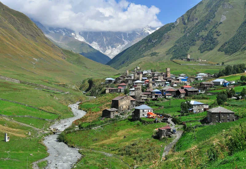
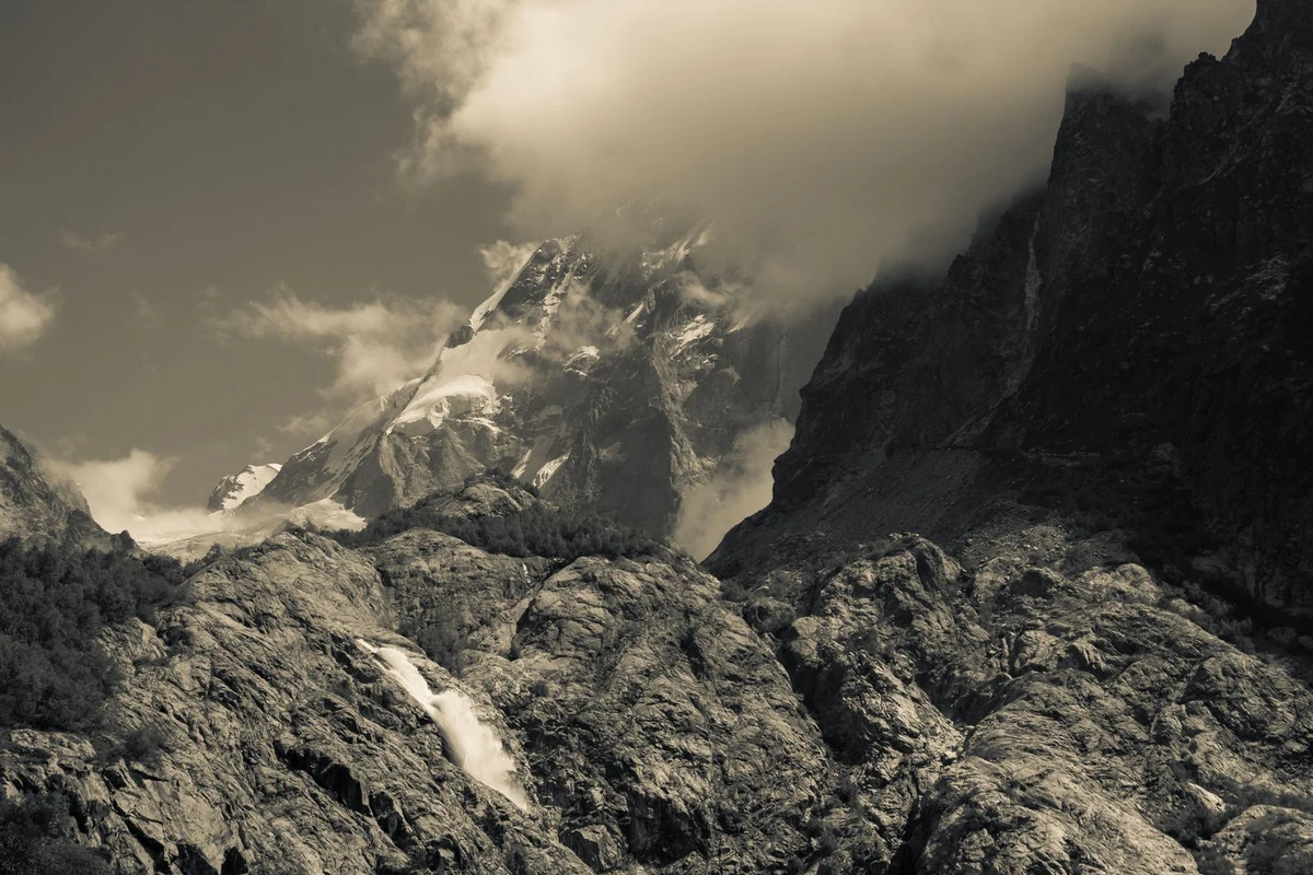
The hike to Shdugra Waterfall is one of those days you end up recommending to everyone you meet in Mestia. It is not the hardest hike in Svaneti, nor the highest, but it takes you somewhere that feels genuinely remote — through pine forest along the Dolra River, past a Georgian border patrol post, and into a steep valley where a large waterfall drops from glacial terrain above.
The whole thing is doable as a half-day trip if you push it, but most people take the full day and enjoy the walk. The trail starts from Mazeri village, about an hour’s drive from Mestia, and gains around 460 metres over roughly 6.5 kilometres one way. No technical skills required — just good shoes and enough water.
This guide covers the trail itself, how to reach Mazeri, where to sleep if you want to stay overnight, and a few practical things worth knowing before you go. For other day hikes from Mestia, see our full Svaneti hiking guide.
About the Waterfall
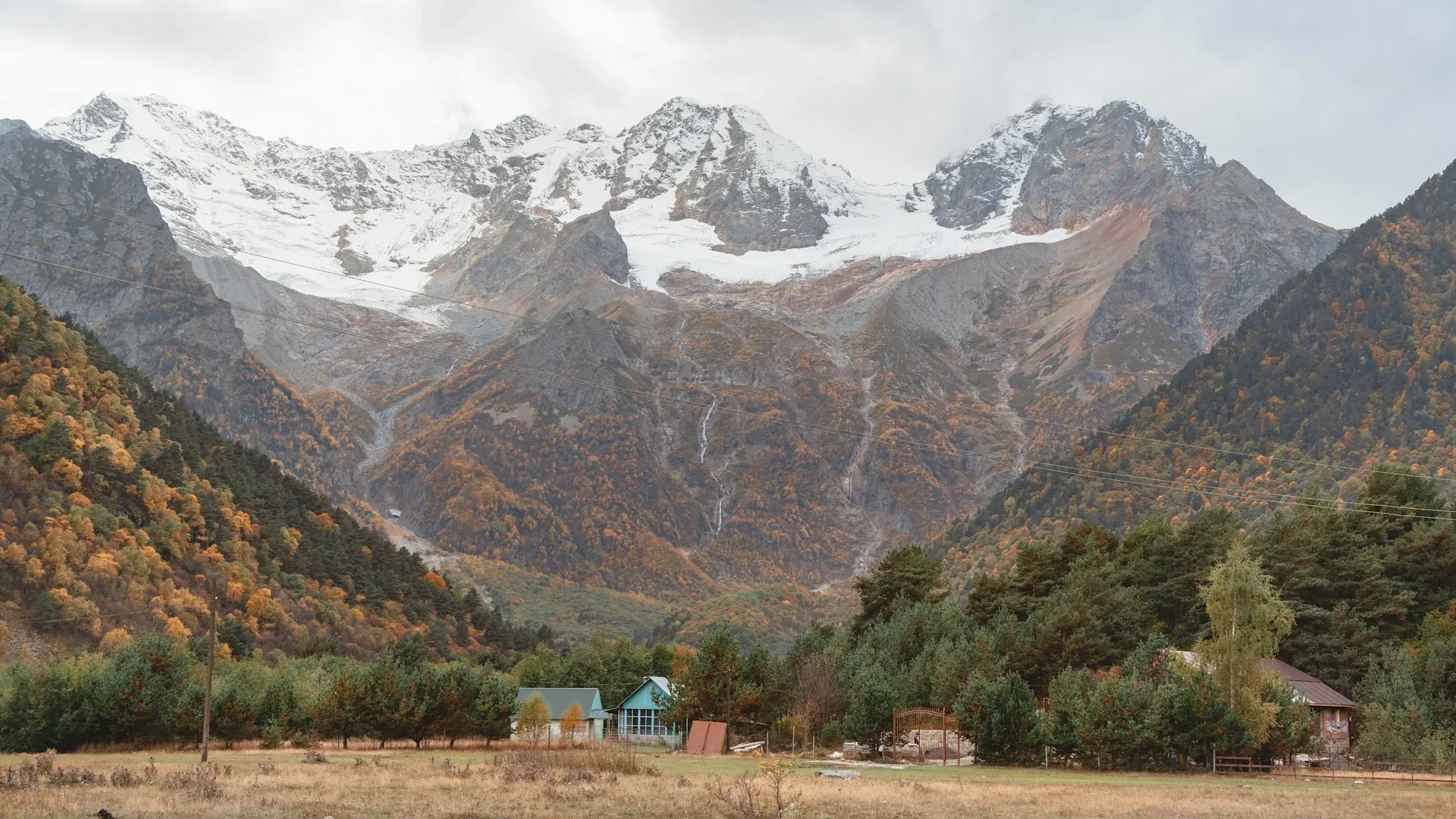
Shdugra sits at the end of the Dolra Valley, fed by meltwater from the Ushba glacier above. The flow is strongest between late May and July, when snowmelt is at its peak — the waterfall is big and loud at that time of year. Later in the season it quiets down a bit but is still worth the walk, and the forest trail in autumn has its own appeal.
The area sits close to the Russian border, which is why you pass a border patrol post on the way in. Most hikers are waved through with a smile, but you need your passport on you regardless.
If you are feeling fit, you can continue from the waterfall turnoff up to Ushba Glacier — it is only about 2.4 kilometres further but gains another 500 metres in elevation and the terrain gets steep and rough. More on that below.
Trail Details
| Distance | 6.5 km one way / ~13 km return |
| Elevation gain | 458 m |
| Max altitude | approx. 2,032 m |
| Difficulty | Easy to Moderate |
| Time | 2.5–3 hours one way, 5–6 hours return |
| Trail type | Out-and-back |
| Starting point | Mazeri village, Becho valley, Svaneti |
| Passport | Bring it — there is a border patrol post on the trail |
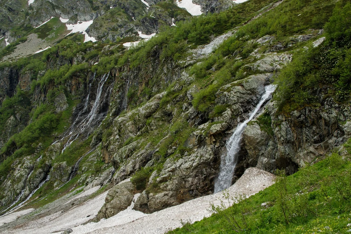
The trail follows the western bank of the Dolra River from Mazeri village heading north. The first half is mostly flat — a comfortable walk through meadows and forest with the river alongside. The second half climbs more steadily through denser forest before reaching the viewpoint near the base of the falls.
The path is mostly clear and well-worn, though it is not an officially maintained trail. There are two food and drink stops along the way — Hikers Inn at around the 3.5 km mark, and the Dau rest area about 2 km further. After Dau, there are no more facilities until you turn back.
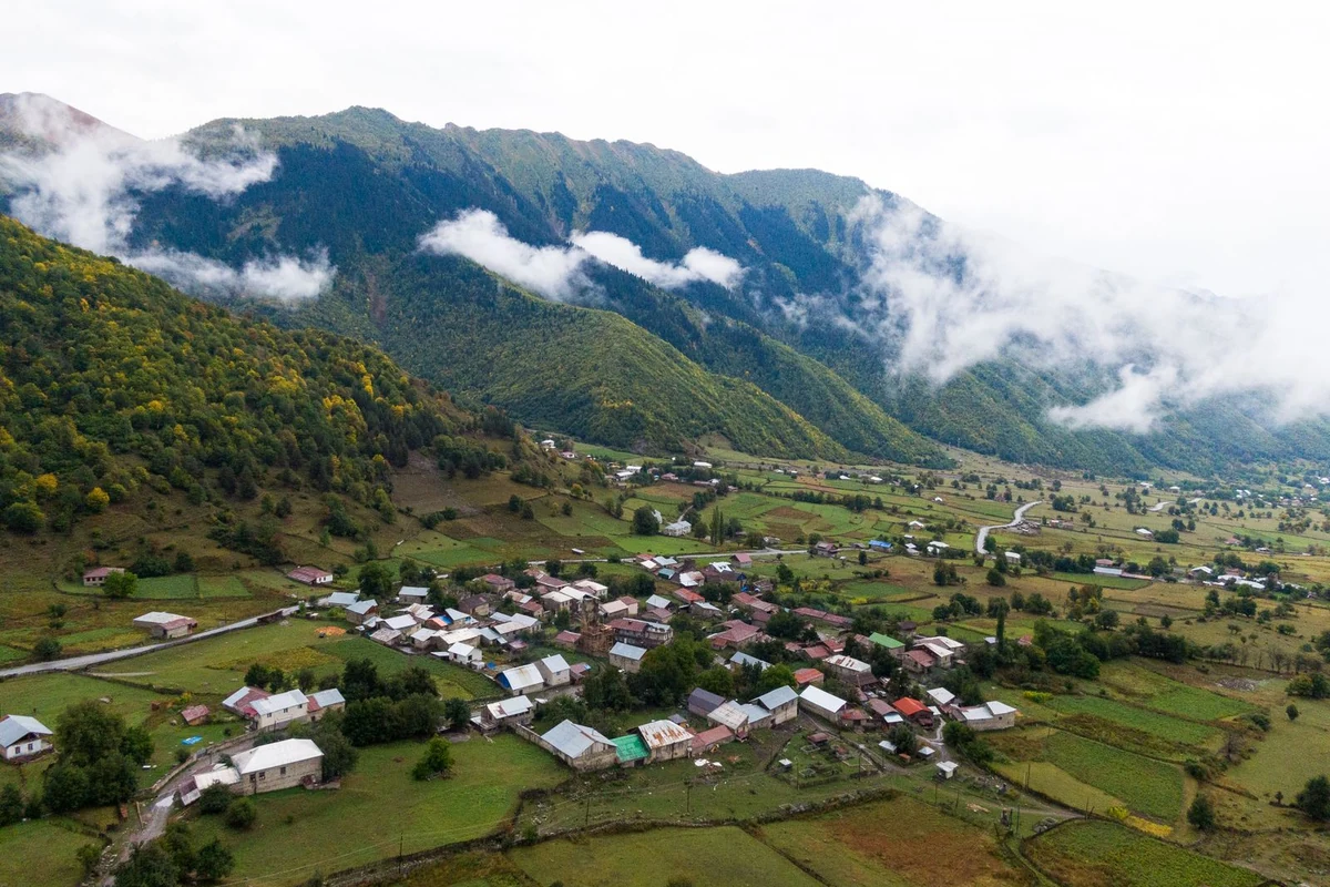
Getting to Mazeri
There is no public transport to Mazeri. The village sits in the Becho valley and the closest marshrutka route stops about 7 kilometres away at the valley entrance. Here are the realistic options:
- Taxi from Mestia: The straightforward choice. Costs around 80–100 GEL (~$30 USD) one way and takes about an hour. Any guesthouse in Mestia can arrange this the evening before.
- Driving yourself: A 4×4 is the right vehicle for the final section of the Becho valley road. The road is unpaved and can be rough after rain. GPS coordinates for Mazeri: 43.084°N, 42.605°E.
If you are staying overnight in Mazeri, your guesthouse can sort out return transport. If you are day-tripping from Mestia, agree a pickup time with your taxi driver before they leave.
The Route, Step by Step
The following is a landmark-by-landmark breakdown of the route. Mobile signal is unreliable on the trail, so it is worth reading this before you set off or downloading an offline map (Maps.me or Wikiloc both have GPX tracks for this trail).
Step 1 — Leave Mazeri heading north (0–1 km)
Start from the village centre and head north. Do not cross the main bridge over the Dolra River — keep to the western bank. You will pass the Tvbishi Mineral Spring on your right shortly after leaving the village.
Step 2 — Through the lumber yard and meadows (1–2 km)
At the trail split, walk through the fence and through the lumber yard, then turn left onto the north-heading path. The trail opens out into meadows with good mountain views. You will pass the small Narzan Mineral Spring on your right, then a small church.
Step 3 — Hikers Inn (~3.5 km)
The trail leads right through Hikers Inn. This is the first place to get food and water on the route and the only option before the waterfall. Worth stopping here if you need to top up supplies.
Step 4 — Dau rest area (~5.5 km)
About 2 km past Hikers Inn, you reach Dau — a simple rest area with food, drinks, tables, and hammocks. This is the last food stop. From here the trail narrows and you start climbing more noticeably through the forest.
Step 5 — Wooden bridge and border post (~5.8 km)
Cross the large wooden bridge over the Dolra and you will almost immediately reach the Georgian border patrol post. The guards will most likely wave you through with a greeting — but have your passport ready. The trail continues straight ahead from the post and climbs more steeply through the trees.
Step 6 — Waterfall viewpoint (6.5 km)
Watch for a yellow sign and red/white trail markers pointing right — this is the turnoff to the viewpoint. Follow the path over a small stream and you will reach the viewpoint close to the river. The waterfall is directly in front of you. Return the same way you came.
Continuing to Ushba Glacier (Optional)
At the waterfall turnoff, if you carry straight on instead of turning right, you are on the trail to Ushba Glacier. This extension is short on paper — 2.4 km from the waterfall junction — but it is significantly harder than the trail you have just walked.
| Glacier extension — key numbersAdditional distance: 2.4 km one way from waterfall junctionAdditional elevation gain: approx. 494 mMax altitude: 2,513 mNote: Do not approach the glacier face — rockfall is a real hazard |
At the waterfall junction, continue straight. Take the left fork at the split, then keep climbing. Around 470 metres in, the trail turns sharply right — this is marked with a cairn but easy to miss. If you find yourself on rocks scrambling upward, you have gone past it.
The trail crosses the river that feeds Shdugra — powerful but manageable, with cairns marking good crossing spots. After a steep push through forest, the trail opens onto a rocky moraine and the glacier comes into view. There is a small memorial here for alpinists who have died on Ushba, which puts the mountain in context.
From the moraine you can see Mt. Shelda (4,368 m) to the north and Mt. Mazeri (4,010 m) to the south. Stay back from the glacier itself — the rock above it is unstable and falling stones are not rare. Return the same way.
Hiking necessities
- Sturdy walking shoes or trail runners with good grip — the trail is uneven in places
- Waterproof jacket — the mist from the falls is significant up close
- An extra warm layer — it gets noticeably cooler in the upper valley
- At least 2 litres of water per person
- Snacks or a packed lunch — Hikers Inn and Dau are the only options on the trail
- Your passport — the border patrol post requires it
- Cash in Georgian Lari — there are no ATMs in Mazeri, so bring it from Mestia
- Hiking poles — useful on the steeper sections, essential if you are going to the glacier
- Offline map downloaded before you leave (signal is patchy from about halfway)
When to go: Late May to mid-October is the practical window. The waterfall runs hardest in late spring and early summer. Autumn is quieter and the forest colours are good. The trail is not passable in winter.
Where to Stay in Mazeri
You can do this as a day trip from Mestia, but staying overnight in Mazeri is worth considering — it gives you an early start, saves the morning taxi rush, and the village guesthouses are genuinely good. All of them include breakfast and dinner, which in Svaneti means a proper spread.
- Lia Jamdeliani’s Guesthouse: A traditional homestay in the centre of Mazeri. Rooms are simple, the food is excellent, and the family is welcoming. One of the more affordable options.
- Guesthouse Shuan: A slightly more modern place at the southern edge of the village near the mineral springs. Hosts Malkhaz and Rita are known for making guests feel at home.
- Grand Hotel Ushba: The most comfortable option in the area, a few hundred metres north of the village. Good rooms, good food. Co-owner Richard is a knowledgeable source on the whole Svaneti region.
- Mila Guesthouse: Known mainly for the quality of its homegrown food. A reliable, friendly option.
Prices generally run around $20–50 USD per person per night with meals included. In July and August, book ahead — Mazeri is small and the better guesthouses fill up early.
A Few Things Worth Knowing
| Bring your passport — the trail passes a Georgian border patrol post near the Russian border.No ATMs in Mazeri — withdraw Georgian Lari in Mestia or earlier.Mobile signal drops out from around halfway. Download an offline map before leaving.Mountain weather changes quickly — start early and keep an eye on afternoon clouds, especially if you are going to the glacier.The trail is not officially maintained — ask your guesthouse about current conditions before heading out.Take your rubbish out with you. |
Nearby hikes in Svaneti
If you are based in Mestia, the Chalaadi Glacier hike is the easiest glacier day trip in the region. The Koruldi Lakes hike is a harder climb but gives panoramic views of Ushba from above. For an overview of all trails based out of Mestia and Ushguli, see the full guide to hiking in Svaneti.
Sources
The trail information and practical details in this article are based on the following sources:
- Caucasus Trekking — Hike from Mazeri to Ushba Glacier: caucasus-trekking.com/treks/ushba
- Transcaucasian Trail — Day Hikes from Mazeri: transcaucasiantrail.org/en/hike/upper-svaneti-georgia/day-hikes-from-mazeri/
- Svaneti Trekking (Highlander Travel) — Shdugra Waterfall Hiking: svanetitrekking.com/shdugra-waterfall-hiking/
- Wikiloc — Shdugra Waterfall Classic Trail: wikiloc.com/hiking-trails/shdugra-waterfall-classic-trail-svaneti-139123368
Prices reflect 2024–2025 data. Trail conditions and logistics can change — it is always worth checking with locals or your guesthouse before you set off.