| Trail at a glance | |
| Distance (from bridge) | 6 km round trip (~3 km each way) |
| Distance (from Mestia on foot) | 14–16 km round trip |
| Elevation gain | 280 m (1,670 m → 1,950 m) |
| Difficulty | Easy (short rocky section near the glacier) |
| Duration | 1.5–2 hrs hiking; 3–4 hrs including taxi transfer |
| Trailhead GPS | 43°06’35″N 42°44’40″E |
| Season | June–October (best: July–September) |
| Entry fee | Free |
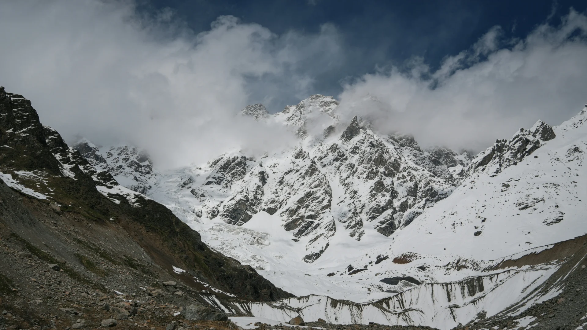
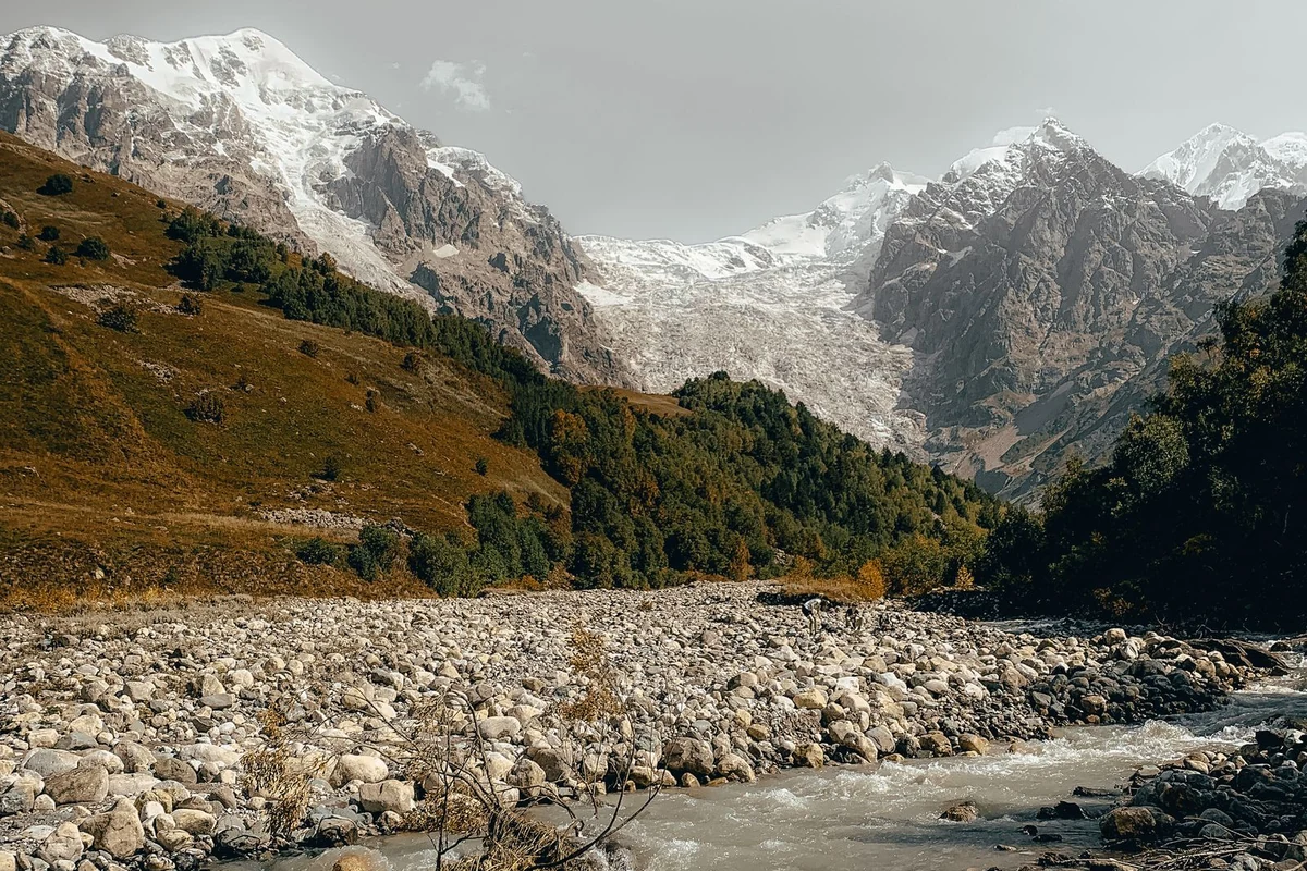
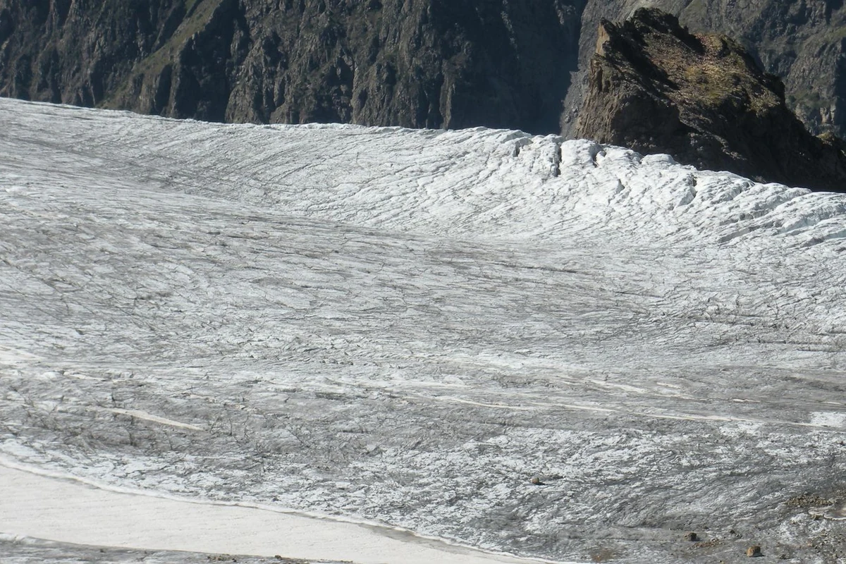
Chalaadi Glacier sits 12 km northeast of Mestia in the Mestiachala RiveChalaadi Glacier sits 12 km northeast of Mestia in the Mestiachala River valley. The glacier is an ice tongue roughly 6 km long, fed by the slopes of Mount Ushba (4,710 m) and the Chatini massif, and descends into the forest zone — unusual for glaciers in this part of the Caucasus. It is the most accessible glacier in Svaneti and one of the easiest to reach in the entire Caucasus range.
The standard approach starts at a suspension bridge over the Mestiachala River, about 9–10 km from Mestia by road. From there, a marked trail leads 3 km through pine forest and across open moraine to the glacier. The hike is suitable for all fitness levels and families with children. No permit, no guide, and no specialist gear are required.
Be aware that ongoing construction of the Mestiachala hydropower plant has made the road from Mestia to the bridge busy with truck traffic. Walking that stretch is no longer practical. Take a taxi or drive your own vehicle to the bridge, then hike from there.
Getting to the Chalaadi Glacier Trailhead
The trailhead is at the suspension bridge over the Mestiachala River. GPS coordinates: 43°06’35″N 42°44’40″E. There is a small free parking area at the bridge, but spaces fill up during summer peak hours — arrive before 9 AM if you are driving.
A shared taxi from Mestia to the bridge costs around 50 GEL (~$18) with the driver waiting for your return. Negotiate the price before you go. If you are travelling solo, ask your guesthouse to help you share a taxi with other guests — most are heading to the same trailhead. There is no regular marshrutka service to the bridge.
Renting a bike in Mestia is another option. Cycling to the bridge takes longer than a taxi but gives you more flexibility. Lock the bike at the border post near the bridge and continue on foot — the final section of trail is not rideable.
| You will pass a border checkpoint at the bridge. Soldiers occasionally ask to see passports, so carry yours. Access to the valley on the right of the bridge is restricted as it leads toward the Russian border — the trail to Chalaadi goes left after crossing. |
The Trail: What to Expect
The trail begins immediately after the suspension bridge. The first 2 km follow a well-marked path through tall pine forest. The gradient is steady and the ground is soft. After about 30–45 minutes, the forest opens onto the moraine — a wide rocky area at the foot of the glacier.
The final kilometre crosses uneven boulders and loose stones. This section requires attention underfoot, particularly in wet conditions, but does not require any technical skill. Trekking shoes or sturdy trainers with grip are sufficient; sandals or flip-flops are not appropriate.
The glacier tongue is visible from the moraine. Do not approach the ice wall or the snout of the glacier. Rockfall and ice collapse occur regularly — fatalities have happened here. Maintain a minimum distance of at least 100 m from the ice. Good views are available from the moraine without getting close.
| Safety rule: Stay clear of the glacier edge. There is no barrier. Rocks and chunks of ice fall without warning. If you hear a loud cracking sound, move back immediately. |
Trail Difficulty
From the suspension bridge, the Chalaadi Glacier hike is easy. The 3 km route gains 280 m in elevation over a straightforward path through forest and moraine. It takes 40–60 minutes to walk one way at a comfortable pace, and 1.5–2 hours round trip.
If you walk the full distance from Mestia, the round trip is 14–16 km with additional elevation, making it a moderate half-day effort. Given the truck traffic on that stretch, this option is not recommended.
The trail is suitable for children aged 7–8 and older, though you should watch footing on the boulders near the glacier. Bears and wolves are present in the area — do not leave food on the trail.
Best Time to Visit
The hiking season runs from June through October. July and September are generally the most reliable months for clear weather and stable trail conditions. In May, sections of the trail may still be snow-covered. By November, snowfall is possible and the upper part of the trail can become icy.
Morning visits give better views. Cloud cover tends to build from midday, obscuring Mount Ushba and the upper glacier. Aim to arrive at the trailhead before 10 AM. Avoid hiking in heavy rain — the moraine becomes slippery and rock instability increases.
Guided Tours and Other Options
The trail is well-marked and straightforward — you do not need a guide to navigate it. Guided tours from Mestia are available if you prefer company or want context about the glacier and local landscape. Shared group tours start from around $25 per person including transfer.
If you want a longer day in the area, the Lekhziri Glacier trail starts near the same parking area. It is a significantly harder route — approximately 15 km — with no trail markings and overgrown paths in places. You need a permit from the local police (a quick process) to access this route as it runs close to the border zone. Ask at the police station in Mestia before setting out.
What to Bring
There are no cafes, toilets, or water sources on the trail. Bring everything you need from Mestia.
- Water — at least 1 litre per person
- Snacks or a packed lunch
- Trekking shoes or sturdy trainers with grip
- Waterproof layer — weather can change quickly
- Sunscreen and a hat — the moraine section has no shade
- Passport — required at the border checkpoint
- Cash in GEL — for taxi and any purchases in Mestia
Mobile signal (4G) is available near the bridge but becomes unreliable on the trail. Download offline maps before you go. Maps.me and Google Maps both cover the route.
Nearby Hikes
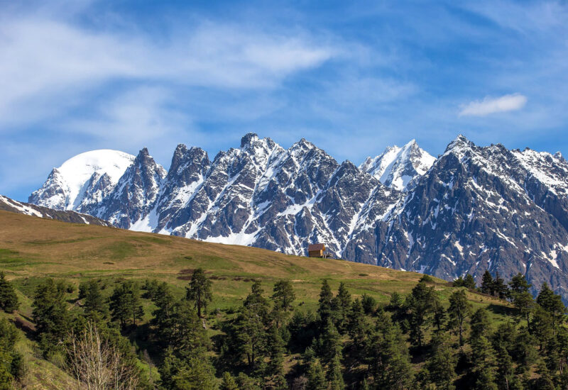
Mestia is a good base for other day hikes. The Koruldi Lakes trail offers panoramic views of Mount Ushba and takes 4–6 hours round trip. The Shdugra Waterfall hike from Mazeri sits beneath the Ushba massif and makes another worthwhile day out. Hatsvali cable car gives quick access to upper alpine terrain. For longer treks, the multi-day route from Mestia to Ushguli follows the Enguri Valley and passes the Adishi Glacier.
Sources
- https://www.caucasus-trekking.com/treks/chalaadi
- https://www.backpackadventures.org/chalaadi-glacier/
- https://svaneti.org/en/destinations/chalaadi-glacier
- https://aleksblog.com/en/chalaadi-glacier-hike/
- https://georgia.travel/svan-glaciers-chalaati
authenticgeorgia.guide | Svaneti Hiking Guides